Go East: Ruby Mountains a Geologic Spectacle, Vacation Destination
Written by Kyle Magin
Scrap every desert cliche you’ve formulated about Nevada’s basin-range landscape. Big brown mountains. Barely-arable basins stretching as far as the eye can see.
Nevada’s Ruby Mountains buck every notion you have about the outdoors the Silver State has to offer.
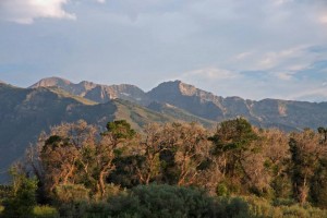
The 50-plus mile-long range–10 miles wide at its thickest–is a haven of lush vegetation, wildflowers and glacially-sculpted lakes. The knife ridges and Alps-like spires first come into view south of Interstate 80 from the boom town of Elko, Nevada, which is “four hours from everything,” says Tom Lester, Elko Convention and Tourism Manager. And it is–it’s within four hours give or take of Reno, Boise and Salt Lake City.
I had the pleasure of visiting the Rubies this past week and haven’t been able to shut up about it since. Geology and weather have shaped the range in a way unlike almost any other in the state. As follows is a brief introduction to the range and the town of Lamoille, Nevada.
The Trip
Point your car East on Interstate 80 and head to Elko, which is about 290 miles east of Reno. Take note of the scenery along the way–much of it a collection of basin-range topographies that to the uninformed eye look largely lifeless. In Elko, hook up with Nevada 227 headed southeast toward Lamoille. Stop in town at Machi’s Saloon and Grill or The Star Hotel for some classic Basque fare, as the Spanish-French immigrants were early to settle the region and retain a strong cultural and culinary influence in the area. The drive to Lamoille is about 20 minutes long and gives you a full-on view of the north end of the Ruby range as you approach. We were lucky enough to catch the range as a summer storm rolled in and illuminated the 11,000 foot-tall range with lightning strikes. It was a lucky sight.
The Base
Our party stayed at Red’s Ranch, which is owned by the same people (Nevada 36 Co.) who operate the historic Thunderbird Lodge here on Tahoe’s East Shore. It’s situated in Lamoille, a gorgeous, stream-fed ranch town at the foot of the Rubies. The accomodations at Red’s are outstanding–the large guest house sleeps 22 and includes a pool, hot tub, spacious common areas and an industrial-sized kitchen. The newly remodeled ranch frequently plays host to mining conventions–the fourth largest gold strike in the world is going on in Elko right now, Lester pointed out–and in the winter serves as the base for the Ruby Mountain Heli-Experience. The outfit takes groups up to the Rubies in winter to ski and snowboard, providing an in-house cook for guests. Lamoille also has an Inn and campground, you can find out more about staying in the area here. Our group had a fantastic dinner at the Pine Lodge (watch out for the mojitos, though! They pack a punch!).
The Range
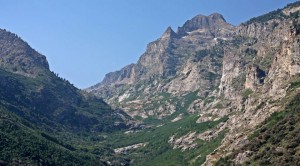
You’d never guess the Rubies for a Nevada locale if you were dropped there without context. Entering the range from the north brings you into Lamoille Canyon–a classic, glacially-carved u-shaped canyon surrounded by rocky crags and bi-sected by the Lamoille Creek. Even our group–experienced Tahoans who can pass a big lake every day without gawking rubbernecked our way through the drive to the canyon’s parking lot. Miles of towering metamorphic rock passed over our heads as we drove in. It was a sight to see. The 12-mile canyon climbs steadily to well above 8,000 feet and is a haven for recreationalists–we passed a steady stream of cyclists, runners and fly-fishers on the way up. If you’re ready for a challenge, members of Elko Velo Club are holding a canyon climb race on August 10.
Gapers shouldn’t feel bad about staring–even seasoned scientists take in the majesty on their studies in the area.
Jim Carr, the Chair of Geological Sciences and Engineering at the University of Nevada, Reno, doesn’t mince words about the spectacular canyon.
“When I saw the glacial topography for the first time, I was stunned,” he says. “Because it’s lesser-known and harder to get to, it isn’t as well known. But, to tell the truth, I prefer that glacial landscape to what you find in Yosemite.”
During the last ice age, a period stretching about 8,000 years, a glacier sat atop the Rubies and carved the range as it looks today, including Lamoille Canyon, Carr says. Hanging glaciers–positioned above the main glacier in the canyon–eroded away to leave a glittering string of lakes in the Wilderness’ high country. That’s in contrast to Yosemite, where the hanging glaciers formed the spectacular waterfalls such as Yosemite Falls, Carr adds.
Uplifted by a series of earthquakes, the Rubies stand out abruptly from their surrounding landscape–think the Sierra’s eastern slope standing high above the high desert of Nevada and California as opposed to the relatively gentle rise of foothills on the California side in the Highway 49 corridor.
The rock in the range is far different than the smooth granite you find in the Sierra–it’s still granitic but more accurately described as a metamorphic rock, says David Berger, chief of Northern Nevada’s hydrologic studies for the U.S. Geologic Survey in Carson City.
The nature of the rock–about as old as the Sierra–creates an unusual hydrologic effect which can partially explain this desert oasis, Berger adds. On the north side of the range, perennial streams flow out from the Rubies, satiating an otherwise arid landscape. On the southern side of the range, water is discharged through underground channels in the Paleozoic carbonate rock and discharged as springs in world-renowned marshes that serve as a refuge for a number of migratory birds and other wildlife. Ruby Lake is a National Wildlife Refuge and photographer’s haven.
Feeding all of it is a strong winter snowpack. A National Forest Ranger our party encountered mentioned the Ruby’s winter was fairly strong–a far cry from the way we’d describe the winter of 2012-2013 in Tahoe. The Rubies get weather on the same traditional west-to-east pattern we get here in the Sierra, with storms rolling off the Pacific, but also on a northwest-southeasterly pattern, bringing moisture down from the Pacific Northwest, says Berger. Those storms lead to a slightly less arid environment in that part of the state and annually fill the Ruby’s lakes and streams, he adds.
The environment also supports some spectacular large fauna–mule deer, bighorn sheep (although numbers are down from a pneumonia die-off last winter) and Rocky Mountain goats.
The Hike
Our group had a short time to spend in the Rubies, but there are any number of scenic hikes to take. The Ruby Crest National Wilderness Trail cuts through the heart of the range, past numerous lakes and peaks, including the impressive Ruby Dome.
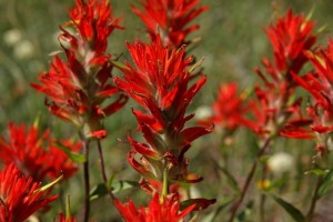
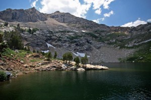
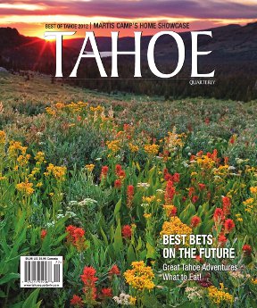
We opted for two hikes–one to Island Lake and the other to Liberty Peak. The Island Lake hike is less than impressive on the map–two miles long with 900 feet of elevation gain–but a supremely pleasant surprise to trek. It’s absolutely stocked with wildflowers–vibrant Indian Paintbrush highlight the trip–to the point where you’re pausing every few hundred steps to take pictures.
The flowers illuminate the whole range, even sun-soaked parts, and provided a gorgeous morning excursion for us. Island Lake is flanked on three sides by beautiful rock outcroppings, and, appropriately, features an island smack dab in the middle. The lake is snow-fed, though, so don’t jump in and expect a warm swim across.
The hike to Liberty Peak gains close to 2,700 feet over about four miles from the main parking lot on the opposite side of the Island Lake trail. Low on the trail you hike through a lush aspen forest (the whole canyon is filled with them, year-round residents say fall is the best time to visit to see the colors) and higher you climb into rocky, tallus-filled terrain, but the trails are great.
We stopped at Lamoille Lake to cool off–a small peninsula provides a great place for a cliff dive.
From there, the hike becomes a steeper, switchback-filled slog, gaining precipitously toward Liberty Pass. Stick with it, because the view is breathtaking.
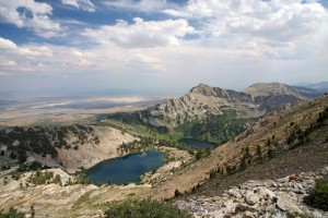
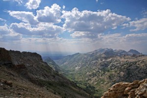
Liberty Pass provides a great view south along the spine of the range; immediately below is Liberty Lake, with Favre Lake just beyond. We scrambled about halfway up Liberty Peak, which is immediately above the pass, to get a good panorama of the range. It staggers the eye–those hanging lakes sticking out in tremendous volume and the knife-edge ridges and spires in full view. The reason for the severe angles is, again, the glaciation, says Carr. Glaciers erode upward as they dissapear, hanging on in the highest, coolest places the longest, he adds. As they erode upward and toward one another, the rock is squeezed and carved in between, leaving abrupt edges and jutting. It’s a fantastic sight.
“I’m always sort of amazed the Spring Mountains (further south) were chosen for Great Basin National Park,” Carr says. “It’s a stunning pleasure to be in the Rubies and see everything you can in that mountain range, it’s fantastic.”
Category: Natural World, Outdoors, Summer



Comments (1)
Trackback URL | Comments RSS Feed
Sites That Link to this Post