Tahoe Trailblazing
Inside the evolving art of trailbuilding
Written by Greyson Howard
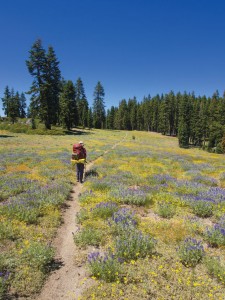
Trails etch into packed earth and chipped stone across the Tahoe landscape, zigzagging up the Sierra’s steep peaks, tracing a parallel course to its streams and rivers, dipping into shaded woods and bursting onto sunny meadows.
Trails are a part of the region’s landscape, just as are the pines, granite, lakes, creeks and valleys. The Tahoe region is home to hundreds of miles of trails, to include the lake-circumambulating Tahoe Rim Trail, the historic Emigrant Trail and segments of the Pacific Crest Trail, which stretches from Mexico to Canada.
While the area’s ski resorts can count lift tickets for winter figures, it’s harder to quantify the draw of trails on tourists, but the Tahoe Rim Trail alone estimates some 100,000 users annually based on surveys and on-trail counters. Mary Bennington, executive director of the Tahoe Rim Trail Association (TRTA), thinks that’s a significant underestimation.
“We’ve done some user surveys, and found out where the trail users are from, and we know that locals are using our trails all the time, but we have people from all over the country and all over the world, too,” Bennington says. “They’re coming to Tahoe, staying somewhere, buying food and buying gear.”
“Trails in Tahoe are extremely important to the community and the economy,” says Garrett Villanueva, assistant forest engineer for the Lake Tahoe Basin Management Unit, noting that there are more than five million visitors to the National Forest per year.
And while users may look at the trail they’re hiking, pedaling, running or horseback riding and see it as just another piece of the region’s wilderness like the trees or rocks, those trails have to be built and maintained, and a lot goes into that process.
Hundreds of volunteers take to the woods each year to build new trails and maintain existing ones. It took 10,000-plus volunteers more than 200,000 hours over the course of 17 years to build the linking pieces needed to create the 165-mile Tahoe Rim Trail alone.
“We can build a quarter mile of trail in a day, or it can take us a whole summer, depending on the terrain,” says John Svahn, stewardship director for the Truckee Donner Land Trust, who runs the nonprofit’s trail building program.
So the question is, how does one go about building a new trail?
The Path to Trails
The Truckee Donner Land Trust puts a premium on trail building as a way to give the public access to the open space it preserves. With the organization, Svahn has built trails in Waddle Ranch in the Martis Valley and along Truckee’s ridge tops to create the Donner Lake Rim Trail; plans are in the works for Independence Lake north of Truckee and Royal Gorge on Donner Summit.
How do he and the region’s other trail builders do it?
“The most important thing to figure out is if there is an actual need for the trail, and then to establish a vision for the trail,” Svahn says. “Different visions could be an interpretive nature trail, a purpose-built mountain bike trail or a multi-use trail for all users.”
That helps establish the character and the traits of a trail, from a rugged wilderness trail meant to get hikers to a destination, to precisely groomed mountain bike trails designed to flow over the landscape in an exhilarating manner.
Looking at the landscape, the trail can be used to bring its users to specific points—a waterfall, a lake, a meadow—or to keep users away from specific points—sensitive cultural or ecological resources, he says.
“The Emigrant Trail does not follow the actual alignment of the historic trail because they didn’t want the historic resources to be impacted; instead it mirrors the historic trail,” Svahn says. “At first people think ‘huh’ when they hear it’s not the actual trail, but when you explain why, they understand.”
The purpose of a trail also defines its shape—a wilderness trail can be winding, whereas an access trail needs to be more direct or else users will find their own way, causing damage and erosion by not staying on an established path. For this reason, says Svahn, trail building standards try to keep the steepness of the path between 5 and 7 percent, though an access trail might kick up to more than 10 percent.
“The next step is poring over topo maps and aerial photographs. You pick control points, a start and a finish. Then you figure out the elevation difference between the two and compute an average gradient. You run the calculation and figure out how long the trail needs to be to stay under that gradient.”
Once a trail has a beginning, an end, an estimated length and control points—that waterfall users will want to see, and the sensitive fawning ground users should be kept away from—it then takes shape on paper, to be built in a rough corridor 50 to 300 feet wide, Svahn says.
Then comes a possibly lengthy dive into permitting and paperwork. Depending on which side of the California-Nevada state line the trail is proposed for, and if it crosses federal land, environmental reviews and permitting must go through federal, California, Lahontan Water Quality Control Board, U.S. Army Corps of Engineers and Fish and Wildlife regulators. The process can take years.
With that out of the way, it’s time to get dirty. The first step is course flagging—typically tying ribbons in trees or putting pin flags in the ground, spaced so the trail builder can see one flag in front and one behind at all times, Svahn says.
Once the alignment is refined, it’s time to start building.
“The Land Trust builds trails with 99.9 percent volunteer labor, which means we have to recruit volunteers,” Svahn says. “It’s a lot of fun and great team building.”
For the Lake Tahoe Basin Management Unit of the Forest Service, that means working with organizations like the Tahoe Rim Trail Association, Pacific Crest Trail Association and Tahoe Area Mountain Bike Association to draw on their members, Villanueva says.
Volunteers begin by clearing out vegetation from the corridor—roughly eight-to-ten feet high and eight-to-ten feet wide.
“A crew has to grub out the roots so plants won’t grow back in the middle of the trail. You want the trail to be mineral soil, not organic material, or else things will grow or the tread could collapse,” Svahn says.
Then, working with tools like a Mattock, a pickaxe-like tool, and a Macleod, kind of like a rake on steroids, the trail itself is cut.
The typical trail is 18-to-30 inches wide. Uphill ground is kept below a 45 degree angle so it doesn’t slump into the trail; the ground downhill of the trail is cut at a gentle angle so water slowly sheets off the surface, preventing erosion and pooling.
“The number one design principle of modern trail building is to minimize the destruction of water,” says Svahn. “Do it wrong and you can cause erosion, starve an area and its plants of water, or drown another.”
If the trail crew comes across big rocks and boulders that need to be moved, they can use anything from lever bars to explosives and even a compound introduced into a drilled hole in the rock that will expand overnight, cracking the rock in half by the next day.
Building trails far from the road, like remote stretches of the Tahoe Rim Trail, crews will camp for a few days while they work, bringing in the heaviest tools on horseback.
All in all, from planning to permits to building, trails cost about $8,000 a mile, even with volunteer labor, Svahn says. A structure like a bridge can cost more than $10,000.
And while that may be the end of building the trail, it’s not the end for those who care for them.
“Every year, 100 to 300 trees fall across the Tahoe Rim Trail,” Bennington says. “Within two or three years, the trail would be impassable without maintenance.”
Over the last few years, TRTA had more than 500 volunteers annually on the Rim Trail just for upkeep, she says.
Another group that puts a high priority on maintenance is the Tahoe Area Mountain Bike Association (TAMBA).
“There are more than 350 miles of trails in the Basin, and none of the agencies have the resources to take care of it all, so our priority is to take care of what we have,” says TAMBA president Kevin Joell.
Still, maintenance can be the hardest piece of the puzzle, Svahn says.
“It’s much easier to secure funding to build a trail; it’s much harder to get money for maintenance,” he notes. “That’s why we design trails to keep maintenance down.”
An Evolving Process
Take a hike around the Tahoe Rim Trail and you might notice a change when the 165-mile path joins tread with the 2,650-mile Pacific Crest Trail (PCT). Suddenly the ups and downs are steeper, rock steps are cut out of granite blocks—it just feels different.
That’s because the two trails are of two different eras, and trail building evolved over time.
“The PCT has been around a lot longer, and it was built to different standards,” Bennington says. “We try not to exceed a 10 percent incline, and if we do it is only in short sections. The PCT was built much steeper.”
The PCT, a national scenic trail open only to hikers and equestrians, was built in the 1960s, whereas the Tahoe Rim Trail, built for hikers, equestrians and mountain bikers (outside of wilderness areas) was begun in the 1980s and finished in 2001.
“It’s all good trail building, just to different standards,” she says.
Water management, as the most important aspect of trail building, has evolved and become more sophisticated, Svahn says.
“Water bars, those lines of rock or humps of dirt across the trails to push water off the trail, are out,” he says. “Now we use a rolling grade that dips down into the trail with a subtle mound behind. They’re cheaper, easier and safer for all users.”
Grade reversals—breaking up long slopes by reversing the pitch—help get water off the trail and also help mountain bikers control speed.
“Generally we’re aiming for less gradient and a more varied gradient to slow down use and manage water,” Svahn says.
The introduction of mountain bikes also affected trail building.
“Prior to mountain bikes, trail users weren’t looking for the trail itself to provide the experience, trails were to go places,” Svahn says. “Now, mountain bikers are looking for things like flow; they care about what’s actually going on under you.”
When mountain bikers first took to older trails, user conflicts started to crop up. Trail builders first aimed for longer sight lines, Svahn says, with the idea that being able to see farther ahead would prevent collisions.
Instead, it just meant bikes went faster, and would skid to slow down, causing damage to the trail.
Now, all the new designs that help manage water on the trails also help manage speed while being more fun for mountain bikers, “a win-win,” Svahn says.
Looking forward, there are more user groups to consider—trail runners, gravity mountain bikers, cross-country mountain bikers, day hikers, backpackers and equestrians.
“One size doesn’t fit all anymore,” Svahn says.
Still, even with all the changes to trail design driven by experience and user groups, the fundamentals are the same.
“I have a Forest Service document on my desk dated April 5, 1906, that talks about laying out a trail. It says to be gentle on the land, follow the contours of the terrain, and even then, they understood that hydrology is arguably the most important piece of building a trail,” Villanueva says. “What’s new is how people use the trails, and the technique has become more sophisticated.”
Mountain Bike
Controversy
As previously mentioned, when mountain bikes appeared on trails, mostly starting in the 1980s, controversy came along for the ride.
Trail builders had to adapt to the new needs of mountain bikers, and build trails in a way that minimized conflict. They weren’t successful in their first attempts, but ultimately trails became better because of mountain bikes—the side effects of the new construction made for better water management as well.
But in the Lake Tahoe region, as with other areas around the country, another issue arose before the new trail designs were dialed in to benefit all user groups—unauthorized trails, Villanueva says.
“One thing that was happening was people making their own trails,” Villanueva says. “They have undocumented impacts; we may not ever know what they destroyed.”
One was found in the Tahoe Basin built right through an important archeological site, with actual artifacts used to build features in the trail, Villanueva says.
“Some were built with enormous gap jumps with no control; kids could go out there and get hurt,” he says. “We were spending $30,000 to $40,000 dealing with the damage.”
But then in 2010, the Forest Service, the International Mountain Bicycling Association (IMBA) and a lapsed Tahoe Area Mountain Bike Association met for a summit, ultimately reigniting the Tahoe group.
“It was a very positive win-win, and we’ve seen a significant decrease in unauthorized trails,” Villanueva says. “TAMBA has been a spectacular partner and one of our strongest volunteer user groups, not just for mountain bikes, but for all trail users.”
TAMBA president Joell says the group, originally founded in 1988, was resurrected at that summit.
“There was a hole that needed to be filled, a group the Forest Service can call up if there is an issue or if they need to rally the troops for trail maintenance,” he says. “We’re up to around 300 members, an active Facebook page and email list, and on our trail days we get a lot done. We want to give back.”
The association followed IMBA’s lead in reducing user conflicts, Joell says, teaching riders it’s a privilege to use the trails.
“We want mountain bikers to respect the trail; we’re all out there for a similar experience,” Joell says. “There are still a few bad apples out there, but I think it has improved a lot.”
Building more trails also reduces conflicts, not only with cyclists, but by spreading all users out so no one place is as likely to become crowded, which is one of the reasons the Tahoe Rim Trail first came to be.
Making the
Tahoe Rim Trail
The vision for the TRT, says Bennington, was that of Glenn Hampton, a Forest Service employee of the 1970s and ’80s who had started to notice a lot of wear and tear on the few areas that had trail access at the time—Desolation Wilderness for example.
“He wanted to get people dispersed throughout the Tahoe area while giving them amazing views all the way around The Lake, so he came up with the idea of running a trail along the ridges of the Basin,” Bennington says.
In 1981, the Tahoe Rim Trail Association was formed to work with the Forest Service to make the new trail a reality.
It took three years of planning and environmental work before a shovel of dirt could be turned, Bennington says, and two decades from the forming of TRTA for volunteers to connect the 165-mile loop.
It connects three wilderness areas—Mt. Rose, Desolation Wilderness and Granite Chief—through two states, six counties, three National Forests and one State Park along the way, overlapping for 49 miles with the PCT.
Since its completion in 2001, Bennington says the TRTA has been hard at work, not only maintaining the trail, but re-routing sections and making better connections.
“There was a section near Tahoe City that was too close to a wetland,” she says. “We re-routed off a fire road onto a new trail near Mt. Rose.” She notes that the group also “connected Kingsbury north and south, eliminating four miles of road walking, and we completed the Rim to Reno Project.”
Get Involved
“We live and breathe by volunteers,” says Bennington. “We love their involvement from building and maintaining trails to guides to ambassadors to helping in our office.”
For those interested in getting involved in building or maintaining trails in the Lake Tahoe region, contact the Tahoe Rim Trail Association at www.tahoerimtrail.org or (775) 298-0012, the Truckee Donner Land Trust at www.tdlandtrust.org or (530) 582-4711, TAMBA at www.mountainbiketahoe.org, Truckee Trails Foundation at www.truckeetrails.org, or the Pacific Crest Trail Association at www.pcta.org.
Greyson Howard is a Truckee-based writer who has hiked the entire Tahoe Rim Trail.
Category: Natural World, Outdoors, Summer


